Aplicativos
- Art & Design
- Auto & Vehicles
- Beauty
- Livros e referências
- Corporativo
- Humor
- Comunicação
- Dating
- Ensino
- Entretenimento
- Events
- Finanças
- Food & Drink
- Saúde e fitness
- House & Home
- Bibliotecas e demos
- Estilo de vida
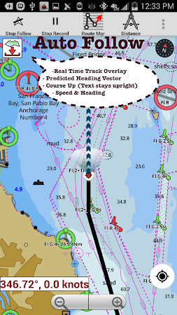
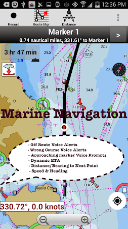
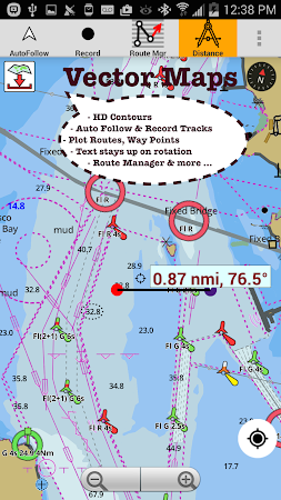
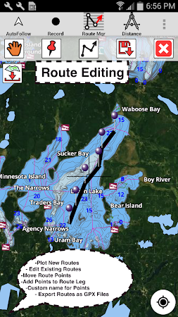
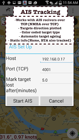
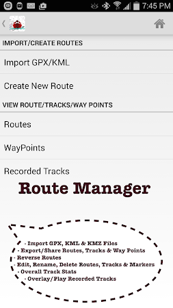
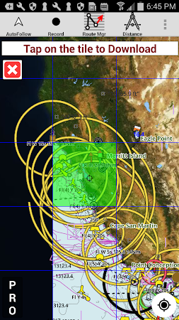
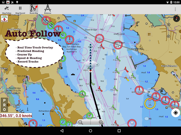
- Maps & Navigation
- Medicina
- Música e áudio
- Notícias e revistas
- Parenting
- Personalização
- Fotografia
- Produtividade
- Compras
- Social
- Esportes
- Ferramentas
- Turismo e local
- Video Players & Editors
- Clima
Juegos

Comentários